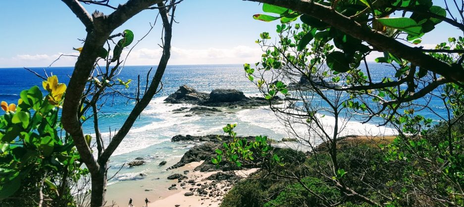
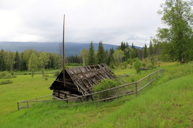
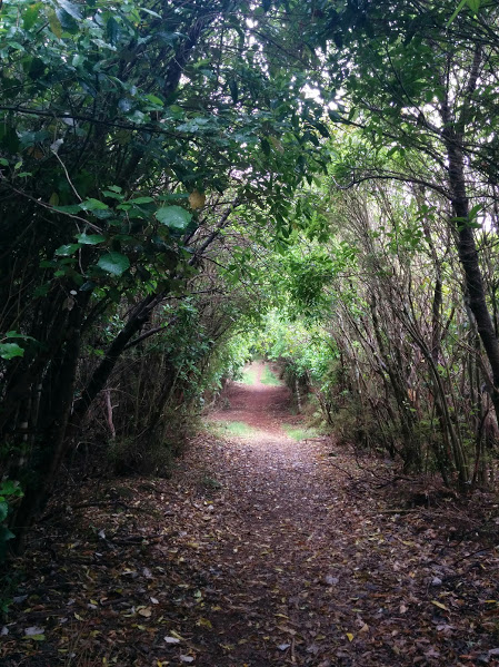
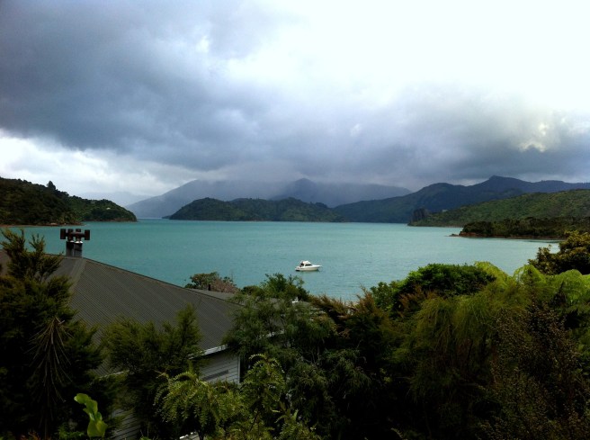
Sometimes,when travelling, the weather gods are not on your side! Driving from Clearwaterto Jasper, on the third leg of our road-trip we intended to stop and see Mt Robson, the highest mountain in the Canadian Rockies. However, we couldn’t soak in what is apparently an amazing view as we found ourselves surrounded by thick mist. All was not doom and gloom however for as we climbed higher, we drove out of the mist into the sun and found ourselves surrounded by the awesomeness of Jasper National Park. Nestled in its heart is the charming town of Jasper, where we settled into our own little cabin in the woods, a charming and comfortable lakeside cottage for two at Patricia Lake Bungalows.
Patricia Lake from the porch of our cottage. It was cold when we were there, so didn’t try the canoes. I probably wouldn’t have fallen in but you never know …
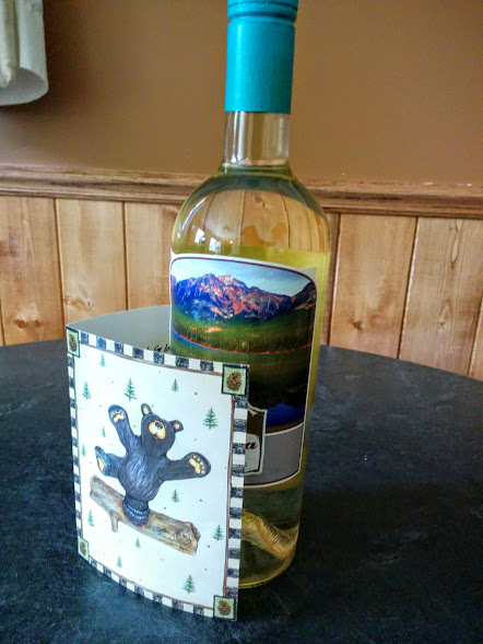
As we were staying for three nights, we had time to really explore some of this amazing World Heritage area. The management at Patricia Lake Bungalows couldn’t have been more helpful and gave us great advice about walks, attractions, the best supermarket, eateries and how to operate the hot tub. Nothing was too much trouble! There was even a special bottle of wine to help us celebrate a special anniversary.
A very nice drop! Thank you Patricia Lake Bungalows!
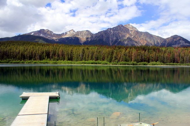
Pyramid Lake and Pyramid Mountain
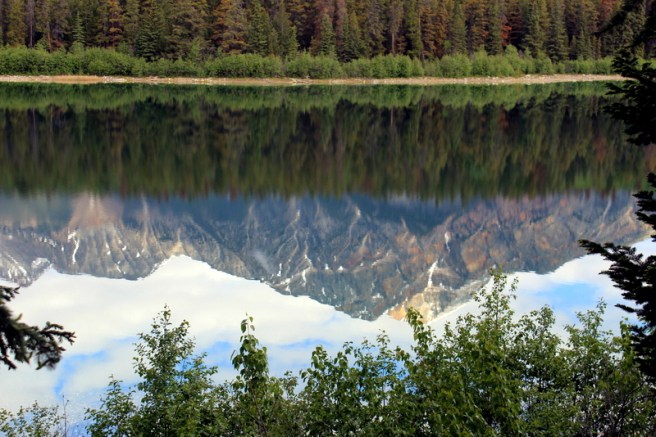
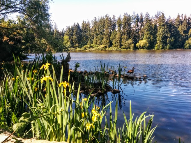
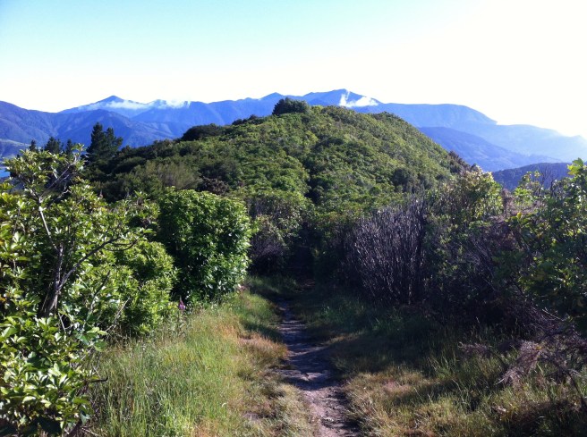
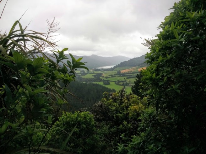
On our first afternoon, we decided to explore Pyramid Lake. Patricia and Pyramid Lakes are just a few kilometres from Jasper township and are connected to each other and the town by hiking trails. In fact, Jasper has so many hiking trails that you have to prioritize. Even though we were staying next door, so to speak, we drove to Pyramid Lake to explore the lake via a hiking trail which took us along the shoreline, past the resort and across a small wooden footbridge to Pyramid Island. There we admired the wonderful views across the lake of Pyramid Mountainand its reflection.
It’s easy to see why it’s called Pyramid Mountain!The lake was so clear and still, perfect for reflections.
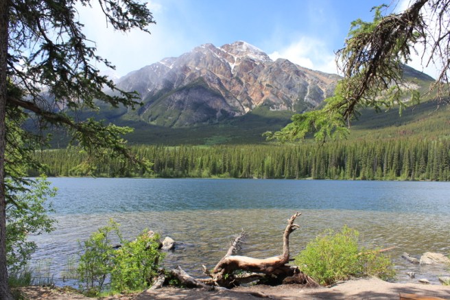
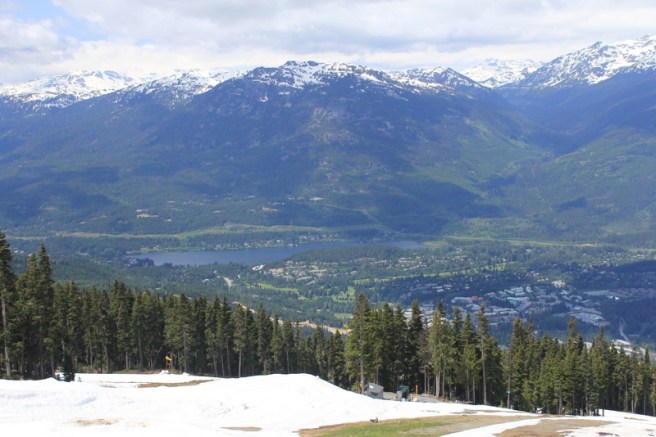
Back home at Patricia Lake, we enjoyed similar views but the snow capped mountains added a special magic I think.
Maligne Canyon and Maligne Lake
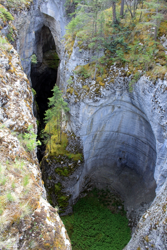
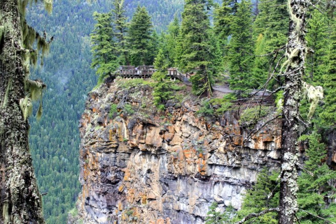
We woke to a cloudy day and decided that it was perfect for exploring. About an hour’s drive from Jasper lies Maligne Canyon and Maligne Lake. Although I had read that the upper Canyon could get very busy when tour buses arrive, I hadn’t appreciated what ‘busy’ meant in this context. We thought we were relatively early; arriving at the canyon around 11am. The carpark was reasonably empty and we smugly set off to explore the excellent self-guided interpretative loop trail that follows the upper reaches of the gorge. We found ourselves crossing the canyon several times, the bridges providing wonderful photo opportunities.
The water churns alongcarving out caves in the canyon wallscascading down waterfallsand disappearing into the forest!
By the time we reached the fourth bridge, an hour or so had passed and it was time to retrace our steps, for we wanted to check out Medicine and Maligne Lakes after lunch. We were astounded by the number of people we encountered walking down, as we climbed to the top. The tour buses had arrived … in droves. Despite the crowds, which at times resembled a herd of wildebeest scrabbling for a spot at the waterhole, this was a wonderful place to visit and explore. Next time, we would like to allow more time to explore the canyon further, as far as the fifth and sixth bridges perhaps.
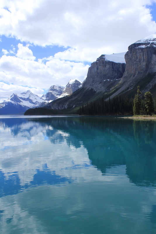
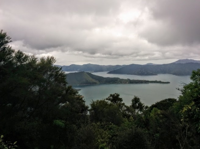
Leaving Maligne Canyon, we drove past Medicine Lake to the beautiful Maligne Lake. Everything about this lake is wonderful. It is the largest natural lake in the Canadian Rockies. Ringed by snow-and-ice-capped mountains, the 22 km long lake stretches past serene Spirit Island right to the melt-water channels of Coronet Glacier.
We lunched at the Maligne Lake Day Lodge & View Restaurant which had an adequate menu and a fabulous view and then explored the foreshore of the lake, learning about some of the history of the area, while some of the locals tried to say hello.
I can see you!
The path winds past the historic boat shed where there are canoes for hire,while the changing colours of the lake invite you to linger … and contemplate.
As the afternoon drew to a close, we returned to Jasper where we still had time to wander around, looking for that special souvenir to bring home and enjoy a leisurely dinner in front of the fire, overlooking Patricia Lake. Bliss!
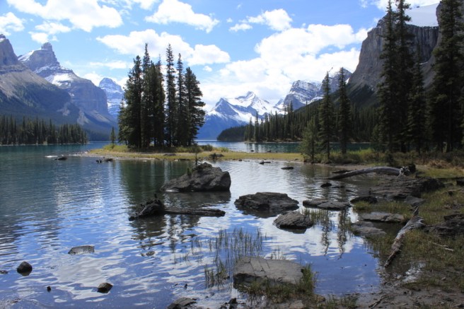
Spirit Island
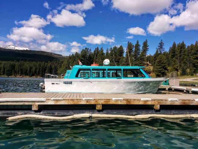
Morning bought sunny weather, so we returned to Maligne Lake and took the Maligne Lake boat cruise to Spirit Island. This boat cruise was definitely one of the highlights of our Canadian holiday. Excellent commentary and amazing scenery made for an unforgettable experience.
The boats are not so big that they intrude on the landscape or impact the environment in a negative way
On the water, we were amazed by the changing colours of the water.
Is it blue, blue green, aqua, turquoise, jade ……?
But nothing prepared us for what awaited at Spirit Island.
Here it is impossible to take a bad photograph for it is so beautiful where ever you look! An amazing place!Even google liked one of my photos and decided to ‘play’.
Alas, our cruise was over all too soon and we headed back to Jasper. Reluctant to let go of the magic, we decided to have a late lunch at the Fairmont Jasper Lodge. There on the deck, overlooking the pool and Beauvert Lake, enjoying a delightful meal and exceptional service, we certainly felt we were living the good life.
All too soon, our time in Jasper was at an end. There was one disappointment. We travelled to Jasper in early June and the road to Mount Edith Cavellwas not yet open. Locals had rated this hike as good as the boat cruise if that’s possible, so this too, will also have to wait till … next time.
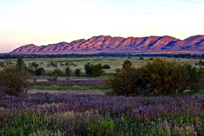
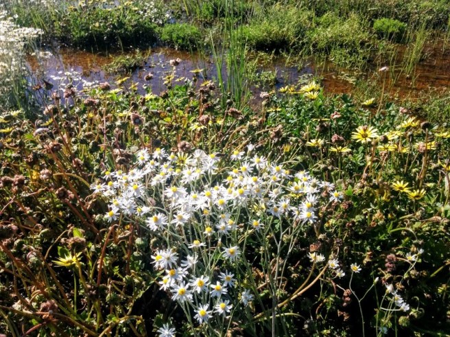
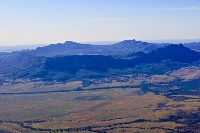
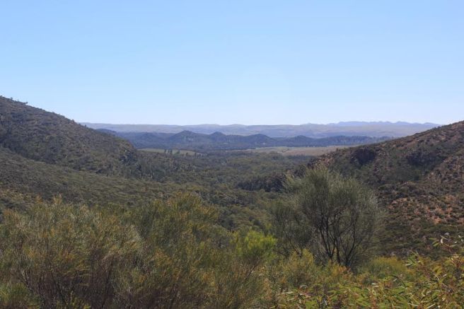
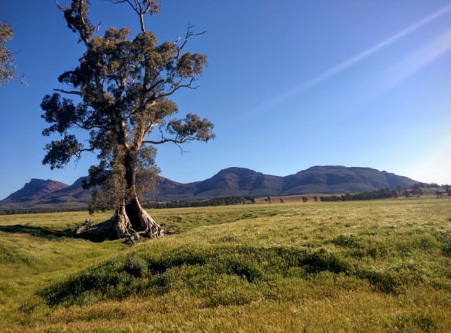
The Chace Range in the Flinders Ranges, as viewed from Rawnsley Park
Our recent road trip to the Flinders Ranges in South Australia could best be described as serendipitous. Quite by accident, we found ourselves in the right place at the right time to witness one of nature’s miracles, a once in ten years sort of miracle!
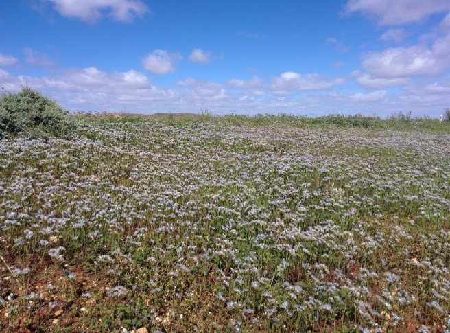
Following extensive and unusual winter and spring rainfall, the dry, red countryside that we expected to find was carpeted with an explosion of wildflowers and greenery. And this carpet was not just here and there, but stretched for hundreds of kilometres, from Nyngan
Drifts of wildflowers near the Bogan River in Nyngan
to Broken Hill
blue puff balls as far as the eye could see
and from the South Australian border
As we drove to each new town in South Australia, there were drifts of gazanias in every colour imaginable!
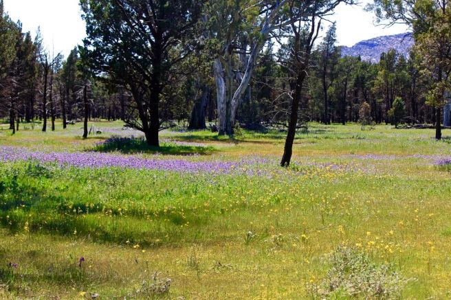
all the way to the green oasis of Wilpena Poundin the Flinders Ranges.
Open grassland in the middle of Wilpena Pound.
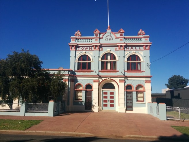
We enjoyed the journey to the Flinders via NSW. Although much of the region was affected by floods with many roads and highways closed, with the exception of a little bit of water over the road on the outskirts of Warren, the Prado didn’t get its feet wet, let alone test out the snorkle. Each town had something to remember it by. In Nynganwe spotted this heritage building.
Nyngan has been a boom and bust sort of place.
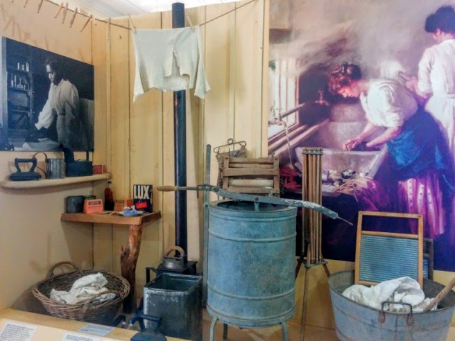
And in Cobar where copper is mined, a lookout on the edge of town lets you look down into the big pit while the museum and visitor centre is worth a visit. The museum offers insights into the indigenous, mining and pastoral history of the region and the everyday life of the early settlers. In those days, a woman’s work was never done.
I’d need a good hand cream after this and my back hurts just looking at this equipment!
Broken Hill did not disappoint either. We enjoyed exploring the city streets where there were lots of interesting things to see such as ‘The Big Picture’ and the heritage listed town of Silverton where the Mad Max films were made. The sculpture park on Sunset Hill was striking and the sunset beautiful. As well, we found a delightful cafe which had excellent coffee and a fresh menu, always a bonus when you’re travelling.
Sun nearly gone!
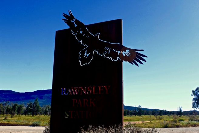
But the star attraction of our trip were the Flinders Ranges. We stayed at Rawnsley Park Stationwww.rawnsleypark.com.auwhich has a variety of accommodation options to suit most budgets. We chose to stay in one of their self-contained holiday units which we found very comfortable.
We stocked up on supplies in Broken Hill and Hawker. After breakfast, we packed lunch to take with us on our explorations , returning for a leisurely dinner each evening.
There are some delightful walks at Rawnsley Park Station. One that we completed was the Ferntree Falls Walk. We were fortunate again because the falls don’t always flow, only after rain! And it had rained a couple of days before we arrived!
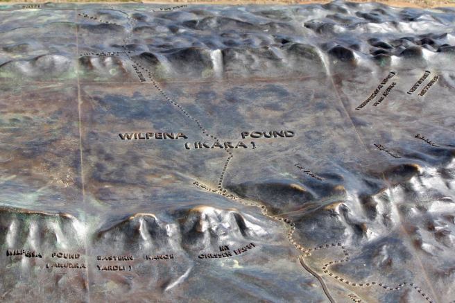
.The following morning we set off to explore. First stop was Wilpena Pound.
Wilpena Pound from the air! An experience not to be missed.
There is an excellent information centre at the Pound and soon we found ourselves walking along a silver gum lined creek
These gum trees looked as if someone had spray painted them silver. And they were so tall!
across bridges
The creek twists and turns
to the Hills Homestead, the early settlers of the Pound
A lonely life
on our way to the Wangara lookout where the view across the pound made the climb to the lookout worthwhile.
It just goes on and on.
Returning to the visitor centre, we had our lunch on the shaded deck while we worked out our itinerary for an afternoon drive. We decided to explore the Bunyeroo and Brachinagorges.
Bunyeroo Gorge is one of the main gorges which runs through the Heysen Range towards Lake Torrens. The drive down the Razorback Ridge to Bunyeroo Valley gives spectacular views South towards the Pound Range.
Kenn has always wanted to drive this road. Finally got his wish and a couple of watery creek crossings as well.
We then drove north to join the Brachina Gorge road which meanders its way through sharp sawtooth ridges of resistant quartzite. This spectacular gorge was once used as a pass through which bullock teams pulled their loads and is now a favourite picnic and camping area.
It was awesome to see where we had driven from the air
Early next morning, we decided to do one of the longer walks at Wilpena Pound: the 18.8 km Bridle Gap Walk which takes you across the pound and back.
The walk captured in bronze
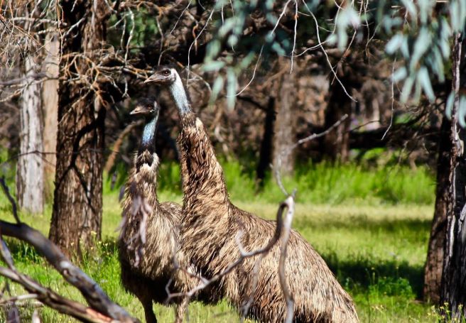
This walk forms part of the Heysen Trail, one of Australia’s Great Walks but it was the wildlife that we saw which made this walk very special. We spotted wallabies and some very friendly emus. For a moment or two, I thought they were going to be too friendly!
The emus were on the lookout for something to chase: a wallaby jumped along and obliged
I also had fun testing out how waterproof my hiking boots were as we crossed little cteeks and lagoons on the walk. Needless to say, my feet in my Scarpa boots stayed dry. These boots aremade for walking!
That afternoon, we explored other gems including the Cazneaux Tree. Cazneaux was a famous photographer. One of his most famous images was taken on 1937, of a solitary river red gum tree, near Wilpena Pound which he titled “The Spirit of Endurance”. Like many others, I took a photo of the same tree which still stands today.
Hopefully, it will still be standing in 100 years time.
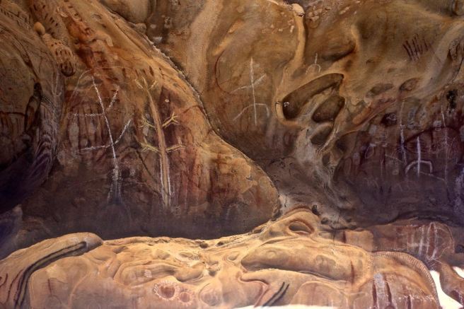
There were Aboriginal rock sites to visit and admire,
just beautiful
lookouts to visit which had vistas over the ABC range and towards the north and a thrilling flightover the area to enjoy. We considered booking this before we left home, but weren’t sure which flight would suit us best. The friendly staff at Rawnsley and Wilpena Pound were very helpful and in the end we decided on a half hour flight from Rawnsley over the Pound and the Gorges. It was not difficult to book a time which suited us and our pilot made the experience one to savour. Thank you, Alex!
All too soon, we were bidding farewell to the Flinders Ranges. We returned to Byron Bay via Mildura where we stopped for two nights. This is a lovely place on the Murray River in the middle of wine growing country. Couldn’t resist trying the local drop and bought a couple of bottles home to share with friends. While in Mildura, we went to Sea Lake.
As you can see, not much to see at Sea Lake except your reflection! We watched amazed as hordes of Chinese girls, dressed in designer clothing walked into the lake and posed while their boyfriends took their photograph in the murky salt lake. Apparently, when there are some clouds, it looks as if you are walking on the clouds!
A couple of family reunions, an extra 6000 kms on the clock and all too soon we were driving into Byron Bay. Home until … the next adventure.
Waterfalls and raging rivers dominated Stage 2 of our road trip as we drove from Whistler to Jasper along a ‘road less traveled’ via Pemberton, Lillooet, Kamloops and Clearwater. This was a very rewarding experience as we were not surrounded by hundreds of fellow tourists, allowing us time to drink in the silence, to find the special magic, that something unique and wonderful that nourishes a connection with the wilderness.
Whistler to Kamloops
Nairn Falls
We left Whistler on an overcast but dry day. We had lots of time to stop and explore along the way as we were only driving to Kamloops and it’s light well into the evening in early June. Just outside Pemberton, we stopped at Nairn Falls on the Green River to stretch our legs and check out our first Canadian waterfall. The walk to the waterfall, along the Green river was lovely.
The path climbed a little but was quite easy. It is a 3 km return walk.Occasionally, I just had to find a seat and enjoy the view and yes the leaves were really this lovely shade of green as the sun was peeking through!The falls at the end of the walk were quite impressive. They are 60 metres high and you can view both the upper and lower falls.
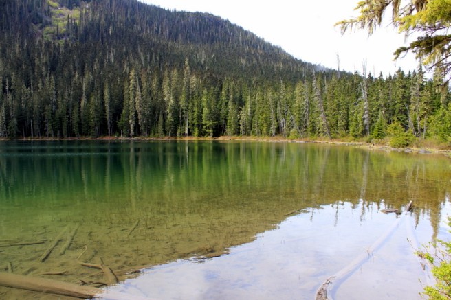
Joffre Lakes
All too soon, we were in the car. Passing through pretty Pemberton, our next stop was Joffre Lakes. We had learned about them from a couple from Adelaide, as we lay soaking in the hot tub at the Summit hotel in Whistler. Alas, Kenn and I didn’t have the four plus hours needed to complete the 10 km round hike, so we just walked along the path to the lower lake.
Imagine what the other lakes are like if this is the least scenic!
Then came the best part of the drive to Kamloops. The road to Lillooet winds through snow capped mountains that seem to hover all around you. The sun kept making an appearance, breaking through banks of clouds, making glaciers gleam and sparkle and frosting the tops of the deep green trees which lined the valleys. Then this alpine perfection changed. As you drive further inland towards Lillooet, the road enters a rain shadow and the countryside becomes sparse and dry creating an interesting contrast with the coast.
Lillooet
This is a little hamlet on the Fraser river and was our stop for lunch at the Rugged Bean Cafe where our meal and coffee were delicious.
I think that British Columbia is the hanging basket capital of the world.
Earlier than we had anticipated, we found ourselves in Kamloops. This was only an overnight stop so we quickly booked into our motel, Accent Inns, Kamloops. (https://www.accentinns.com) We were pleasantly surprised at how comfortable and well equipped our room was, considering this is a 3 star rated motel. Guided by a lovely receptionist at the Inn, we explored the riverside park in the heart of the city where the Fraser and Thomson Rivers meet.
There was a river beach but it was quite dangerous to swim there according to the warning signsIndigenous carvings enlivened the park
Kamloops to Jasper
Clearwater and the Wells Grey Provincial Park
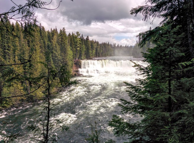
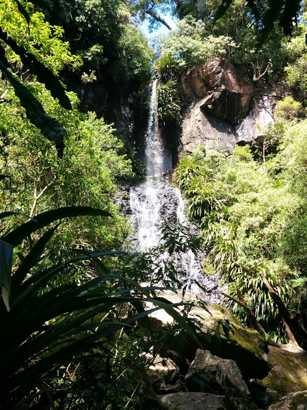
Next morning, after a simple breakfast at Accent Inns, we found ourselves bound for Clearwater, gateway for the Wells Grey Provincial Park. No-one seemed to know about this park back in Australia but I was intrigued by some comments on a couple of blog posts I had read while in the research phase for our trip. Waterfalls, waterfalls and more waterfalls, the blog posts enthused. Worth a stop I thought!
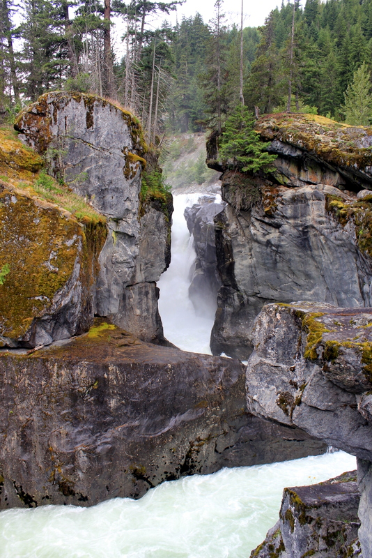
Clearwater was only about an hours drive from Kamloops and our first port of call was to the park information centre. With a limited time frame, they were able to advise us which of the many waterfalls we should visit and which walks were feasible. So map in hand and my navigator’s cap on, we drove into the park. Our first waterfall was the Spahats Creek Falls.
Falling into a steep gorge, this waterfall impressedWe were reminded a little of the Blue Mountains in NSW
Next came the Dawson Fallsor ‘Mini Niagara’ according to the locals. This too, was quite impressive I thought.
The path takes you along the river to the top of the falls.
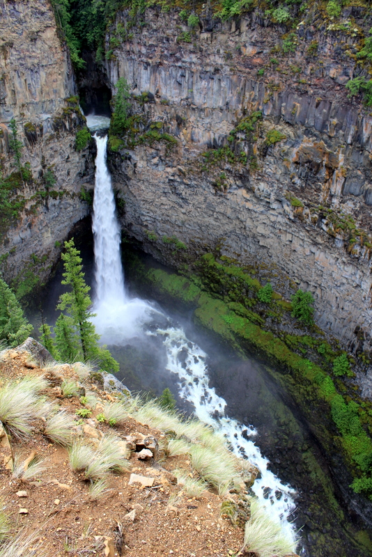
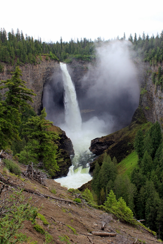
But we saved the best for last, the lovely Helmcken Falls on the Myrtle River. Firstly, we walked for about an hour to the top of the falls along the Rim Trail. This was a great hike as you follow a rampaging river hurtling along to the falls. The sound is amazing!
You wouldn’t want to slip!
Reaching the top of the falls, you find yourself surrounded by mist and spray.
It’s a long way down!
Now you see it, now you don’t
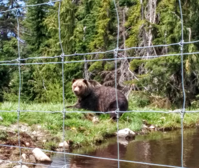
Retracing our steps along the Rim Trail, we encountered a young couple coming towards us exclaiming excitedly, ” Did you see the bear?” We hadn’t, but soon after heard some ominous growls emanating from deeper in the woods.
‘There’s a bear in there … ‘sang Kenn to torment me!
Thankfully however, we didn’t have a close encounter (I love bears … from a distance) and I can assure you that while I didn’t set a new land speed record, I did make it back to the car very, very quickly.
Soon, we were on our way to the viewpoint for a panoramic view of the falls. the waterfall was really beautiful and I loved the way the Canadians have made the viewpoint so accessible for everybody.
So beautiful and we could see where we had hiked – notice the spray near the top of the falls? That’s where the Rim Trail leads to.
Finally, our day trip into the Wells Grey Provincial Park ended with a visit to an early settler’s now abandoned homestead. One could only wonder how they coped with the isolation and the cold in those early years.
Such a simple life!
Finally, it was time to retrace our steps to Clearwater and find the Hummingbird BnB, our home for the night. We were thrilled to see some deer and a couple of bears crossing the road on our way. One of the benefits of staying in a BnB is that you get to experience a place like a local. Some of our most memorable meals in Canada came from a recommendation from a BnB host. Doris, our hostess in Clearwater, recommended the Hop “N” Hog Tap & Smokehouse. And it was wonderful. Sipping signature beers and working our way through a gigantic plate of amazing ribs, we wished that we could stay a little longer here and perhaps take a white water rafting trip. Maybe next time.
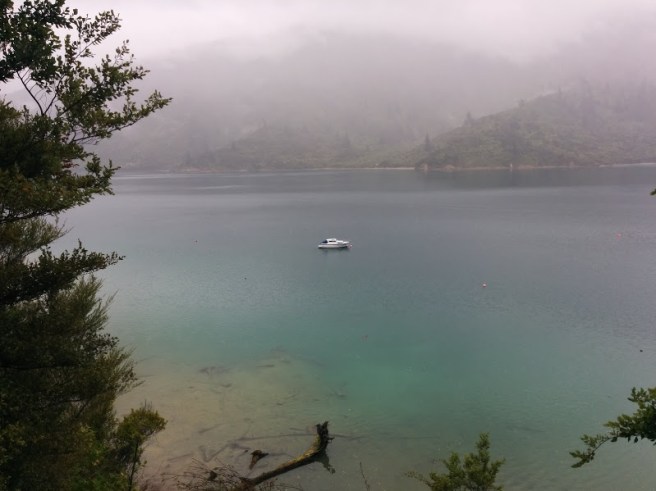
Next morning, while Doris served up a lovely breakfast, we saw hummingbirds for the first time in the wild. So tiny and so fast! Then we were on our way to Jasper. Doris had recommended stopping at Mount Robson Provincial Parkon the way, but when we got there, it was so foggy and overcast that we drove on past. I will have to look at the highest point in the Canadian Rockies another time. This part of the drive to Jasper was spectacular. I suspect that I looked a little like one of those clowns that you see at a country show: mouth always open, head moving constantly from side to side!
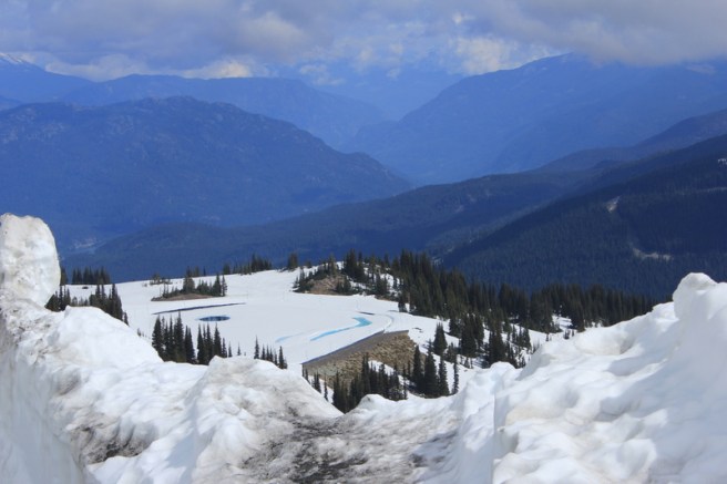
A road less traveled and that made all the difference
Whistler was the first stop on our road trip through the Canadian Rockies and proved to be one of the highlights of our trip. It had it all: mountains for as far as you could see, metres of snow, tranquil lakes hidden in woods so dark and deep, I thought I was in a Robert Frost poem and a charming, accessible, snow globe village. My daughter, Melissa and her husband Ben spent a year in Whistler, as many young Aussies do, and to this day it holds a special place in their hearts. I now appreciate why they found it so difficult to come home!
Getting There
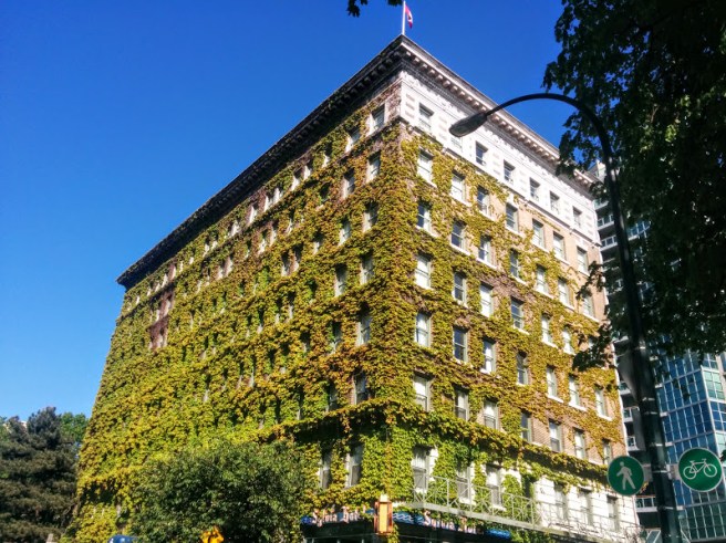
On a cloudy, grey day, with our luggage in tow, we made our way from the Sylvia Hotel in the West Endto the airport where we picked up our car. Using the excellent bus and train system, it was surprisingly easy and cost only a few dollars. Having said that though, a taxi would have only cost us around 25 dollars. We chose the former because we had time and wanted to pretend we were young backpackers if only for a few hours.
Grey clouds threatened but blew away
The drive from the airport into the city and over the Lions Gate Bridge to the North Shore was not too difficult. Our car didn’t come with sat nav and we chose not to upgrade. Kenn was confident that he still had excellent map reading skills and sure enough we soon found ourselves zooming over the bridge and onto the Sea to Sky highway. We had scarcely travelled 30 kms and the weather started to clear. The highway skirts the coast with wonderful views over the ocean and then climbs firstly to Squamishand finally to Whistler. The drive was breathtaking, so much so that I forgot to take photos. I just wanted to look and look some more.
The Summit Hotel and Spa
We stayed at the Summit Hotel and Spa located on Main St close to the Marketplace and the Town Plaza, a great location as it turned out. Initially, I chose this property because I found an incredible special on booking.com and after checking with Melissa re location and facilities, booked. In fact it was so good, that when we went to check in at reception, the girls had never seen a booking so cheap! Was I a forger? A cheat? The back records had to checked to verify my booking.com reservation confirmation. A few anxious moments … and then smiles all round.
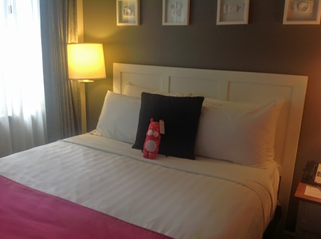
A very comfortable bed – a good night’s sleep was enjoyed by all.
We certainly couldn’t fault our apartment. It featured a separate bedroom, a living room complete with kitchenette and gas fireplace, a luxurious bathroom and a delightful balcony overlooking the pool and hot tub with views to Blackcomb mountain. A perfect home away from home for four nights! Leaving our unpacking for later, we spent a wonderful afternoon exploring the village and getting our bearings. Just around the corner from the Summit we discovered an Aussie pie shop (peakedpies.com) which had an amazing variety of gourmet pies at reasonable prices. Just the thing for a late lunch.
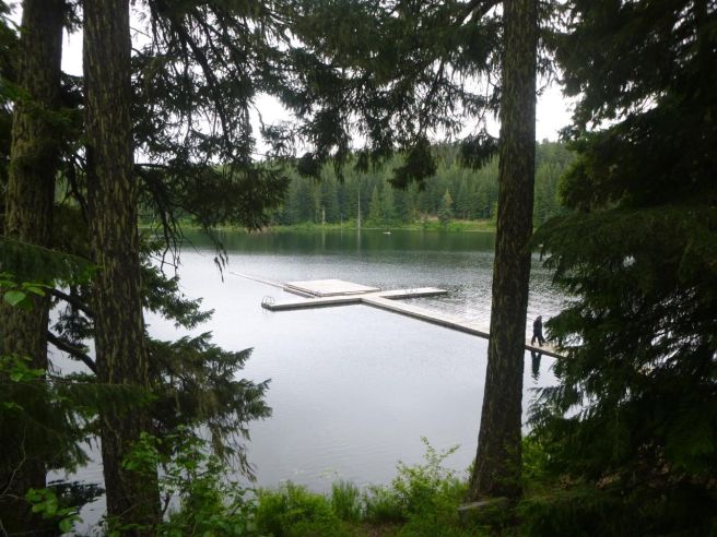
Lost Lake
The next day dawned cloudy, cool and overcast but rain was not predicted so we decided to walk the Lost Lake loop. This was on Melissa’s must do list. It was an easy 5 to 10 km walk. Initially we walked through woods, dark and deep until we reached the lake.
The path was very easy to follow. For bikers there were lots of side trails of varying difficulty. Something for everyone!
Crossing a wooden bridge over a bubbling stream,
Almost has a Japanese garden feel to it, don’t you think?
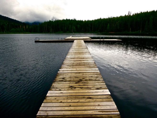
we came to a pontoon.
Such a calm day.
Here we had to stop . There’s just something about wooden walkways that invite one to explore…
It was all ours to enjoy
This would be a perfect spot for yoga, I thought. I could visualise myself attempting downward dog listening to the water lapping the deck, drifting into a zen like state. But my vision was shattered when Melissa told me that this is a favourite swimming spot for the nudist community. I couldn’t believe anyone would actually enjoy swimming here. I had dipped a toe into the water and even if I had a thermal wetsuit on, I wouldn’t dive in let alone clothed only in my birthday suit! Bits would freeze off I’m sure.
We resumed our walk and every turn of the track seemed to give us yet another vista of peacefulness. We returned by taking the track to the upper village along a delightful covered bridge.
Lost in the mist
What lurks in the bushes?
The symmetry of the roof makes for an interesting photo opportunity.
It was time to tick off another item on Melissa’s must do list. Eat a zog dog and poutine. Essential Canadian fare! I can’t report that we found them super delicious. A Zog dog is a saucy hot dog and poutine is basically hot chips with gravy and cheese curds. They were a bit salty and stodgy, perhaps best consumed on a cold winter’s day after a run down the mountain. Then, I imagine they would really hit the spot. We wandered back to the Summit where we enjoyed an hour or so in the hot tub and sauna before indulging in a great value for money dinner at the Spaghetti Factory.
We loved the food and the atmosphere of this eatery. However, I discovered that they only do a naked Caesar Salad – lettuce, croutons, dressing and Parmesan cheese. No chicken, no anchovies, no bacon, no egg! Probably better for the waistline though.
It was packed but it was no hardship to sip a cocktail or two while we waited for a table.
I was very happy after one or was it two of these?
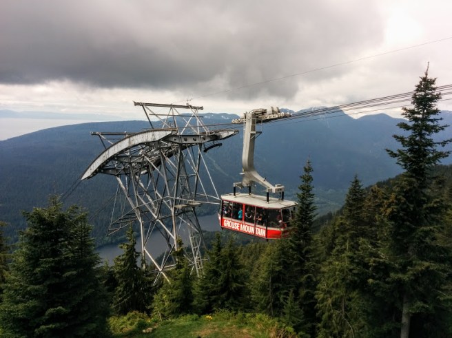
The Peak to Peak Gondola
This has to be the best gondola ride on the planet. The sheer scale of the Peak to Peak Gondola is breathtaking. We scored a beautiful day and made the most of it. First of all, we rode the gondola up Whistler mountain.
As you can see, the gondola gives you unparalleled views all around.
Up you go, up some more and when you think you have reached the summit, you go up, up and up! Below, the village dwindles away.
So far away!
As the summit, we grabbed a bite to eat and then explored a little before climbing aboard the Peak to Peak gondola.
A hive of activity.
We found the Olympic Inunshuk and of course took a photo in front of the Olympic Rings.
I love how Kenn has captured the alpine colour palette in this photo
Going across to Blackcomb mountain on the gondola allows you unparalleled mountain and valley views. We were lucky enough to catch the glass bottom gondola as well. It’s a long way over as you can see in these photos.
Once we reached Blackcomb, we watched the skiers and snow boarders flying down the mountain. Skiing in late Spring! We could have caught the gondola back to Whistler mountain and then down to the village but decided to catch the Blackcomb chairliftdown the mountain instead. And we saw bears! Playing in the flowers! What a day!
There were a couple of bears but obviously they didn’t want to pose together for us.
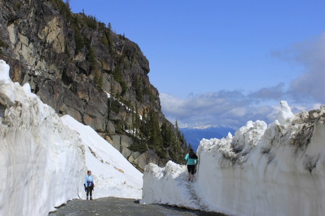
Walking on top of the world.
The following morning was also wonderfully sunny, so we caught the Whistler gondola up the mountain again to walk the only Alpine track that was open. It took us to Little Whistler Peak. Although we have walked to the summit of Mt Kosciuszko in Australia, this was very different. There was so much snow and ice and we were so much higher. The air felt so clean, so good that you just wanted to drink it all in.
The walk follows a service road and climbs very steadily to the peak. As you round bends in the road and look behind you, wonderful vistas open up.
We couldn’t believe our eyes, so, so beautiful.
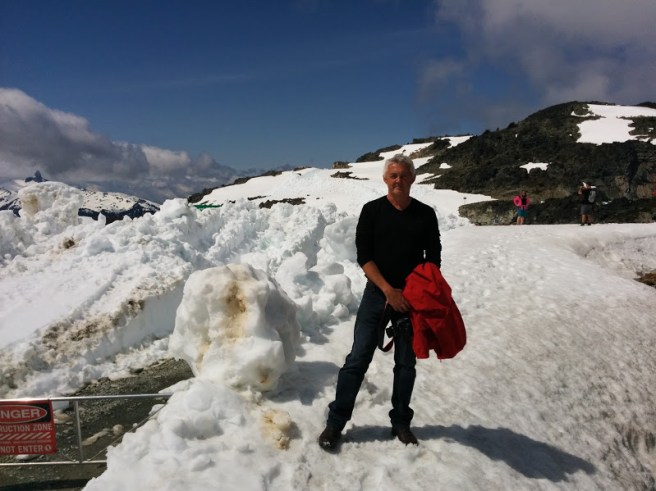
Soon, we found ourselves walking between walls of ice that seemed to get higher and higher as we climbed.
This is one wall that I would not be able to leap with a single bound!
And there were ice sculptures!
I thought that this looked like an elephant. Am I being too fanciful?
All too soon, we were at the end of the walk, feeling at one with the world.This was such a lovely thing to do. Descending on the gondola, we were captivated by the mountain bikers taking on the mountain. This was not an activity that I wanted to pursue but what an adrenaline rush for the riders!
In his element – Kenn loving life!
These were some of the highlights of our Whistler stay. Of course there was so much more: museums, cafes and restaurants, bike rides and of course hot tubbing our aches and pains away under the stars, just to list a few.
While Whistler comes into its glory in the winter, it’s a wonderful destination that offers so much all year round to visitors of all ages. We were sad to go.
Lost Lagoon in Stanley ParkRock sculptures on English Bay
Do you ever secretly wonder if a place you are about to visit will live up to all the wonderful things you have been told about it? Perhaps wonder if the weather will slow you down or keep you indoors when you want to wander, explore or perhaps challenge yourself? Or perhaps worry that the hotels you’ve booked over the internet will turn out to be bedbug ridden dives instead of delightful gems worthy of a rave review on Trip Advisor? I don’t think that I’m a glass half empty sort of a person, but flying over the Pacific Ocean, on our way to Vancouver, some of these thoughts flitted across my mind.
And when you have had some reservations, how good is it when everything turns out to be so much better than you imagined! Turning on fabulous weather, known as bluebird days, for us, Vancouver turned out to be one of the loveliest, most accessible and fun cities I have visited: a place where the forest meets the sea surrounded by snow-capped mountains. I felt guilty for ever imagining that it could be any different.
We arrived early morning and made our way from the airport to our hotel, The Sutton on Burrard St, by taxi. Here we met our friends, Helen and Phil, who had arrived a day earlier. The hotel very obligingly checked us in at 9.00am (book in is usually 3.00pm) and after a shower, we were ready to explore our surroundings.We were all catching an Alaskan cruise the following day and after the cruise, planned to spend a few days in Vancouver before heading off on our separate adventures. All up, we spent five days, four nights in Vancouver.
Day One
Vancouver is a very easy city to walk around and to me at least, didn’t seem crowded at all and if you don’t feel like walking, the bus, rail and ferry system is excellent and very affordable. I was stunned to see so many cyclists safely navigating the city traffic, something we don’t see as much here in Australia. Initially, while Helen and Phil went cycling around the sea wall, Kenn and I walked to Canada Placeon the harbour where we would be boarding our cruise ship.
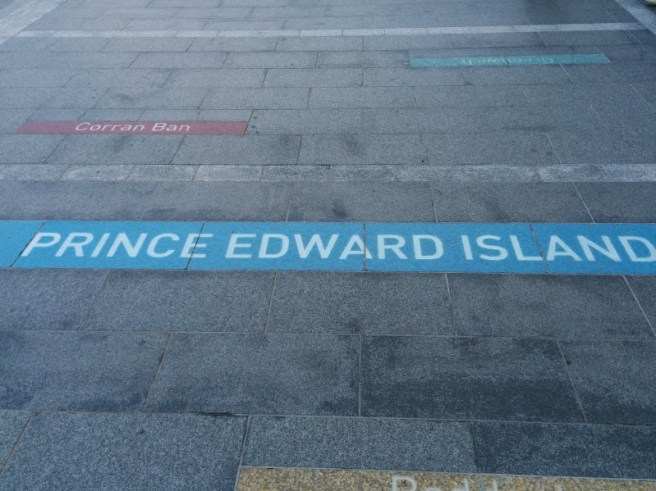
There were signposts on the deck to other parts of Canada. Couldn’t resist – I can’t be the only fan of ‘Anne of Green Gables’ !On our way to Stanley Park, along the sea wall, we found the marina.
We then made our way along the sea wall to Stanley Park. Words cannot do this park justice. Because I was feeling a little jet lagged, we only explored the city side of Lost Lagoon, leaving the park for a more thorough exploration when we returned from the cruise. The combination of sun, sea, trees and flowers was intoxicating, much more effective than a double shot latte for lifting one’s spirits after the long flight from Australia.
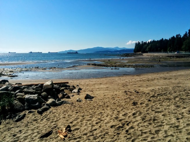
Exiting the park at English Bay, we munched on the best hot dogs for lunch, while watching the tankers round the point.
Bit different from Byron Bay.
We were amazed by the number of locals who were out sunbaking, (though they need to visit Byron to experience a ‘real’ beach), rollerblading and cycling along the promenade. They seemed to exude a real zest for life and the outdoors, which was infectious. I felt healthier just looking at them.
Then it was back to the hotel for a bit of a rest before dinner in Gastown, a short walk from our hotel. Phil led the way to pre-dinner drinks at the Black Frog, a very atmospheric watering hole, specialising in local beers and wines while Helen discovered the culinary delights of the Flying Pig for a memorable first Canadian dinner. From our upstairs window, we had a great view of the famous steam-driven clock and the fairy-lighted streets.
Day Two
What a difference a good night’s sleep makes! Next morning we were up early, ready to explore a little in search of that special coffee and a light breakfast. They take their coffeeseriously here and we were spoilt for choice. In the end, we chose a cafe that specialised in Italian coffee and had a cute outdoor dining spot.Then a quick peak at the shops before we made our way to Canada Place ready for our Alaskan adventure.
Day Three
A week passed all too quickly on the cruise and we found ourselves disembarking on a cloudy Friday morning. We caught a taxi to our next hotel, The Sylvia on English Bay. I had chosen this hotel for its position on the Bay, the price and its proximity to Stanley Park. It was really very comfortable, considering that it was rated as a 3 star hotel. We had only a partial view of the sea but our room was large and comfortable and the views from the restaurant and hotel bar more than compensated.
Our room was on the sixth floor. Hotel has many original features including the lifts.
Luggage stashed, we made our way to Granville Island, a gourmet’s paradise. We took a baby ferry ( these ferries look like they should be in someone’s bathtub) and were there in no time. There was so much produce on display in the food halls that it was difficult to make a choice. Eventually purchasing some artisan bread, cheese and salumi as well as home made soup and new season berries, we found ourselves a comfortable seat on the wharf and indulged in lunch while buskers entertained us. There were lots of handmade arts and crafts as well for those looking for something a little different to take home.
We spent the afternoon at the Vancouver Aquarium, located in Stanley Park. If you love animals and the sea, this is a must see. Every gallery was fascinating but I especially loved watching the children discover the clown fish in the tropical gallery and learning to touch the starfish in their purpose-built environment.
Nemo is so cute!
I laughed along with everyone else at the antics of the beautiful Beluga whales, gleefully splashing unsuspecting members of the audience. And what’s not to love about super frisky sea otters?
Another plus for The Sylvia was that it is close to the restaurant precinct along Denman St.When in a new city I prefer to dine out, enjoying the people, savouring the scents and the lights of the city at night. We eventually chose a Turkish restaurant for dinner. I should have asked how big were the portions as they were enormous and Kenn and I could have shared. For those who like to eat in, I noticed that many of the restaurants did take-away which would be cheaper as you wouldn’t have to pay the tip.
Day Four
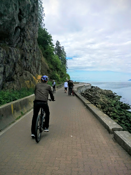
Another fine day greeted us. After a very hearty breakfast in the lovely dining room at the Sylvia, we headed off to Denman Stto hire some bikes. A ride along the sea wall that borders Stanley Park beckoned us. This is a very easy, flat ride along a designated bike path. Kenn and I were soon zooming on our way. There was only one problem. When I found myself nearly falling off my bike because a delightful bunch of Japanese girls were giggling their way around, ahead of me, I knew I wasn’t the slowest bike rider on earth anymore. Indeed, I had to master overtaking or topple off!
I saw a lot of Kenn’s back on this trip!
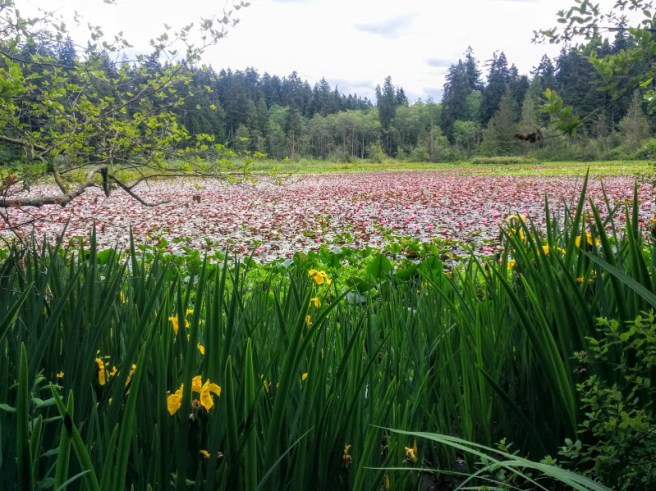
Then it was time to really explore Stanley Park. We had lunch at the Tea House Restaurant, not realising that it was an upmarket establishment. They very kindly let us in despite being dressed in exercise clothes. We then walked deeper into the Park. We found our way to Beaver Lake which was covered in waterlilies about to burst into bloom.
Beaver Lake in late May
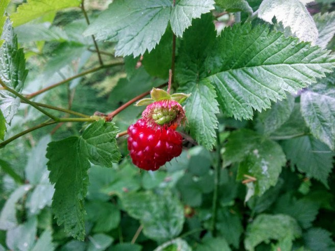
It’s always interesting, the people you meet on your expeditions. As we were leaving Beaver Lake, I stopped to look at some berries which looked very appealing but which I thought might be poisonous. A young man stopped and told me that they were Salmon Berries and edible! Lucky me! But its a small world. It turns out that he is an iron man, training to compete on the Sunshine Coast in July.
A tart taste but nice.
The rose garden, as one might expect, was full of beautiful roses, some of which were scented.
Day Five: The Grouse Grind
Today was the day when my fitness would be tested. Kenn and I had agreed to join Helen and Phil on a jaunt to Grouse Mountain. They wanted to walk up the mountain and catch the gondola down, a walk known as the ‘Grouse Grind’ and advertised as being ‘Nature’s Stairmaster’. We used public transport, a seabus and a bus, to get to the beginning of the walk at the base of the mountain. This was indeed a tough climb, 853 metres (2,800) up to the top of the mountain. But while the trail is not long, (it’s only 2.9 kilometres long) you feel as if you are climbing a steep staircase as the average gradient is about 30 degrees. But it is beautiful walking up through the forest.
Steps and more steps and more steps
It took time and a lot of pit stops … a lot of pit stops. They have a competition in Vancouver to see who can post the fastest time for the grind, I think that I was in a competition with a few others, to see who could post the slowest time. But a couple of hours later, I was thankfully relaxing in a delightful cafe on the summit, sipping a hot chocolate and perusing a menu full of healthy and hearty food options. After all, I needed to refuel!
But there’s more to do than the grind on Grouse Mountain. There’s lots of wildlife to see: Grizzly bears and birds of prey as well as a lumberjack show. For those who ride the gondola up, there are lots of hiking trails to explore as well. They didn’t really appeal to me for some reason.
The two grizzlies were having a lovely play together.
And then it was time to go down via the gondola and enjoy the amazing view over Vancouver and the ocean.
Certainly a tram with a view
Making our way home, picking up some Epsom salts on the way,( a long soak in the bath was definitely in order), we discovered some beautiful old streets in the West End with some delightful architecture. I would have liked to explore these more but you can never fit everything in.
As it was, the weather had been so ‘bluebird’, I hadn’t made it to an art gallery or a museum or a theatre, something I like to do when in a foreign city. But in a way, I think that the beautiful natural environment of Vancouver is what makes this city so special and I’m glad she shared it with us.
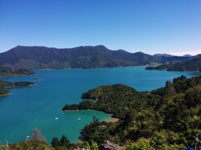
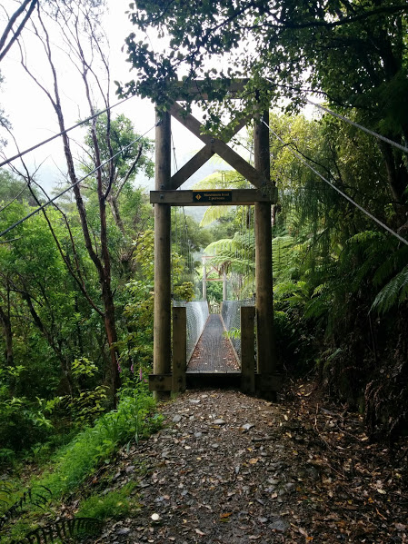
Like most who tackle the Queen Charlotte Track, we walked the actual track in four days. But as this was our first long distance, multi-day hike, we added a rest day at Portage Bay.
This was mainly my idea. I knowmy limitations. While I’m up for a challenge, I didn’t want the walk to become a punishment. I knew from past experience, that walking for eight hours up hill and down dale would leave me a trifle knackered. A good dinner and a Pinot Grigio might not be sufficient to restore my spirits. My feet might need rest and some tender loving care if I wanted them to happily walk a further 20 kms to Anakiwa to finish.
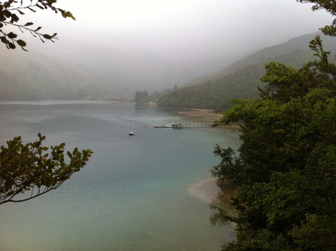
So we rested at the Portage Hotel. As we soaked in the hot tub, massaging our aches and pains away, we congratulated ourselves on our decision. Following a gentle stroll in the rain, the weather closed in and we were content to curl up on a comfy sofa before the open fire, meet fellow travelers and hope that the weather would clear overnight.
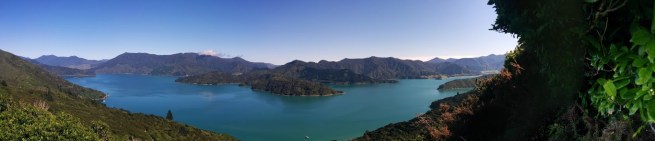
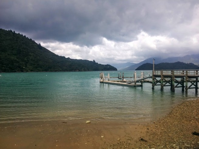
PORTAGE BAY TO MISTLETOE BAY
After all the rain, the clouds disperse
After three days of overcast weather, imagine how thrilled we were when we were greeted by sunny skies. The Portage Hotel supplies a courtesy bus that takes walkers up the hill to rejoin the track. There we tackled the hill that would lead the way across the Torea Saddle to Mistletoe Bay.
ever upwards
This is quite a hill but the views from the top were amazing.
The bays just seem to go on forever.
This section was challenging enough. I was huffing and puffing my way downhill towards Mistletoe Bay when a party of Primary School students passed us going uphill. Some were darting up ahead while others were almost skipping up the hill, singing as they went. Such stamina! No wonder, New Zealand produced Sir Edmund Hilary.
MISTLETOE BAY TO ANAKIWA
After Mistletoe Bay, the track takes a downhill turn and it’s easy walking to Anakiwa.
I’m not complaining, love a steady downhill.
There are still wonderful vistas over the sound but the vegetation is changing. There are more flowering plants.
This reminded me of a wild fushia only biggerI think that this Manuka
But even on this section, the water is beside you, shimmering shades of aquarmarine.
I’m a happy wanderer
Then, all of a sudden it seemed, we were at sea level, walking through beech forests past little coves with sandy beaches.
We’re nearly downWould love to return to explore these beaches
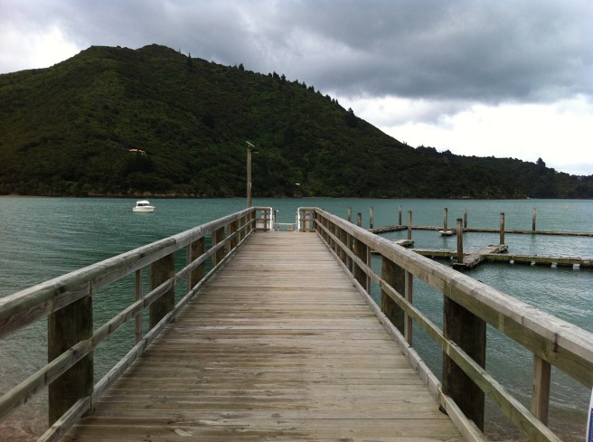
Before too long we reached our destination, Anakiwa. We were sore…and tired…but oh so happy. We enjoyed an ice cream while we waited for our Cougar Line water taxi to pick us up. As we skimmed over the water on our way back to Picton, everyone was quiet, reflective, treasuring their memories of the panoramas of the Queen Charlotte Track.
Day 3 was indeed challenging. All along, I had been worried about this section of the track. Not only was it approximately an eight hour, 24.5 km walk from Mahana Lodge to Portage Bay, examination of the elevation map had shown me that I would be walking uphill … a lot. To complicate matters, the weather was even mistier and more overcast than on Day 2.
However, we refused to be daunted. Our gear had dried overnight and it was with a sense of adventure that we set out. The first hurdle, walking a kilometer or so up a steep driveway and road to rejoin the track, was negotiated rather easily. Then I realised I had left my phone/camera in the Lodge. I felt a little like Eeyore as I walked back down, retrieved the phone and walked a little more slowly up the road again. Just a couple of extra kms that I didn’t need to walk! Not that anyone was counting. My feet were not amused.
But the track soon lifted our spirits. Climbing the Kenepuru Saddle, we circled around a valley lost in time.
How green is my valley? Even in the rain!
Then the detour to Eatwell’s Lookout appeared. But the clouds were darkening and the mist seemed thicker so we decided that the lookout would have to wait for another trip.
Stormy skies
But as this photo from nz.geoview.info shows, on a fine day, it would have definitely been worth walking the extra few kilometers. You can look out over the sounds, all the way to the North Island!
Eatwell’s Lookout. Oh for a sunny day!
After Eatwell’s Lookout, the track climbs and climbs. I thought that it would never end. Kenn remarked that it was like completing the climb to the Byron Lighthouse, 20 times. No wonder my thighs were on fire! Well as they say, no pain, no gain!
But all good things come to an end and eventually the covered rest shelter at Bay of Many Coves, that Ann Martin had suggested as our lunch stop, came into view.
Bay of Many Coves. View from the lunch shelter.
There, surrounded by the happy chatter of junior high boys on a school field trip, Kenn and I enjoyed our magnificent lunch. It gladdened our hearts to see so many young people on the track having such a wonderful time and not an iPhone or earplug in sight.
Bay of Many Coves Campsite to Portage Bay
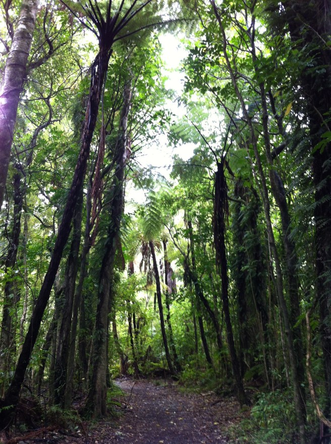
Leaving Bay of Many Coves, the track meanders through the forest. The uphills seem a little easier and there is definitely a lot more downhill. Yippee!
Tunnels of vegetation
Every now and then, we would come to a vantage point that overlooked the sounds. Even under grey skies, it was breathtaking.
The water is still beautiful under grey skies
But as the afternoon wore on, the skies lightened a little and the sun tried to sneak through.
The light is trying to break through.
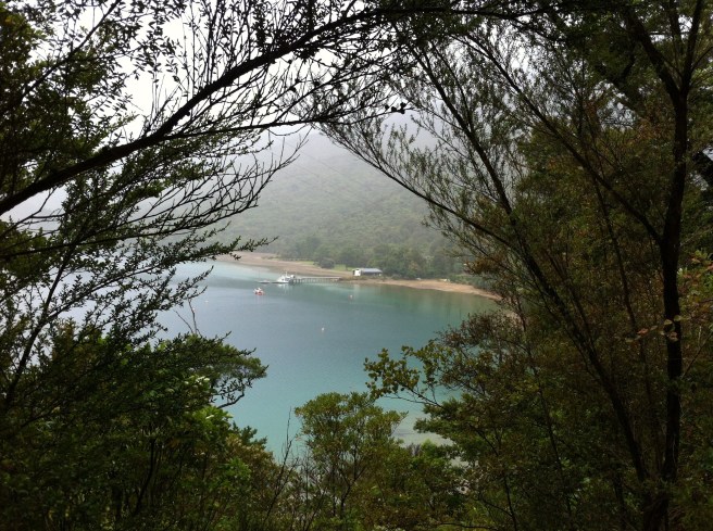
A couple of climbs later, we reached Black Rock campsite. We stopped for afternoon tea and breathed a sigh of relief. Only 7kms to go. And mainly downhill too. As we gently spiraled down into Portage Bay, it was tree fern heaven and at last we were there and the tranquil waters of the bay lay ahead.
The jetty at Portage Bay
I won’t lie. We were knackered. We had been dreaming of a hot shower, soft shoes, a stiff drink (well I had been) and something tasty for dinner for many hours. All this and more was waiting for us, at our home for the night, the Portage Resort Hotel.
I thought back over the day. Would I do it again? Definitely! Ann Martin was spot on. Today had been very challenging, but oh so rewarding.
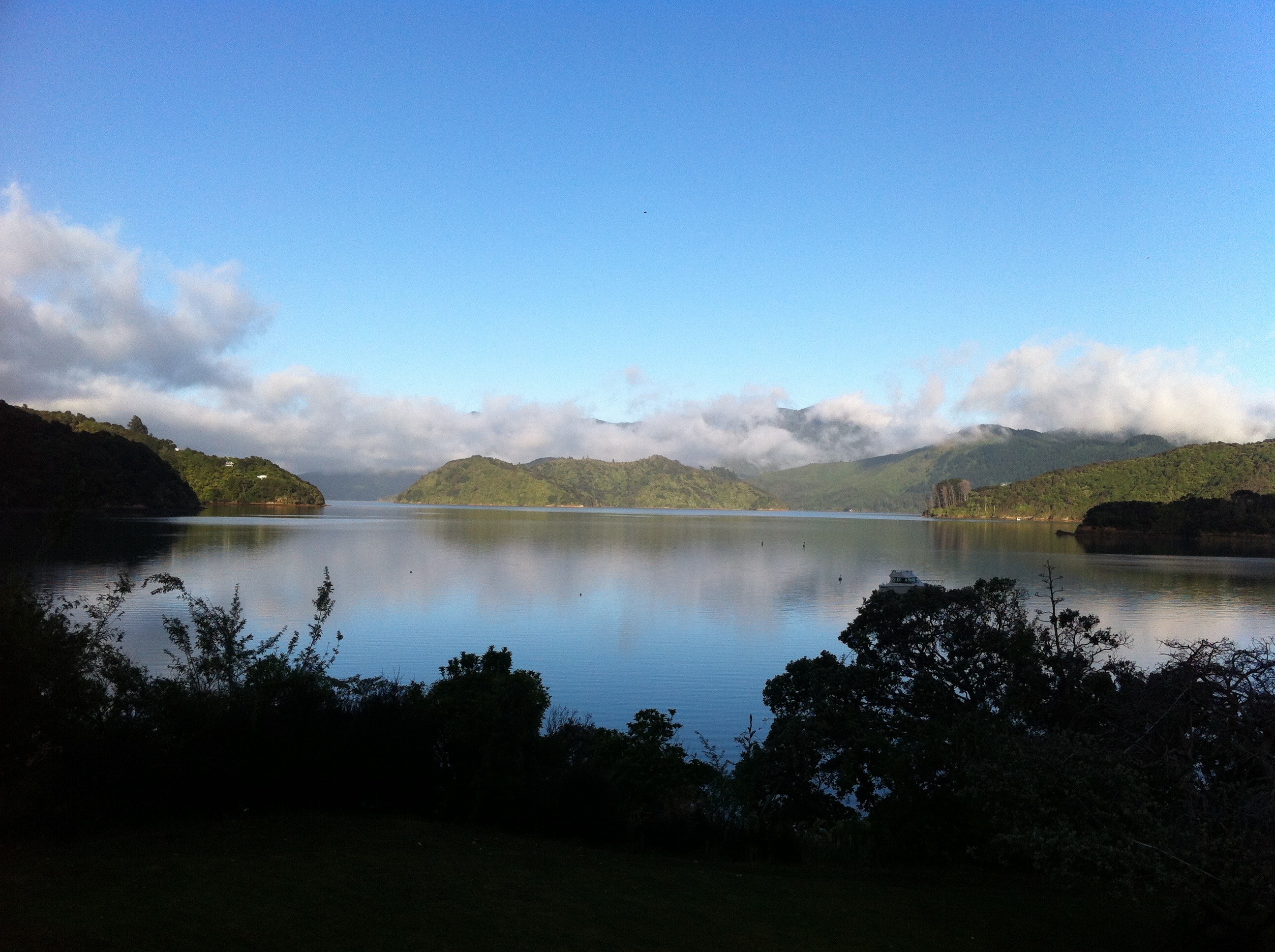
New Zealand isn’t known as the Land of the Long White Cloudfor nothing. We woke on Day 2, to a misty, cloudy day, for our walk around Endeavour Inlet to Mahana Lodge, our destination for the night. This was a relatively easy walk of around 15 kms as our chosen accommodation for Day 1, Cnoc na Lear, was situated on the northern side of the inlet.
Cnoc na Lear to Furneaux Lodge
The mist subtly coloured the landscape, giving it an otherworldly dimension as we walked the 2 or 3 kms to Furneaux Lodgewhich is located in a wonderful setting at the head of the inlet.
View from Cnoc na Lear across the Inlet to Furneaux Lodge jetty
The weather also gave us the opportunity to test some of the gear we had purchased for just such an occasion. I have to say that my Kathmandu merino t-shirt and rain jacket passed the test. I was super comfortable and dry all day. I will admit though, it’s not a look you will see on a Paris catwalk.
Dressed for the rain in my Kathmandu gear at Furneaux Lodge
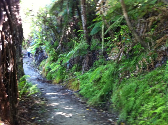
Furneaux Lodge to Miners Camp
This part of the walk passes through ferny forest and traverses the head of the Inlet.
If you have time to spare, there’s also a waterfall or two to visit near Furneaux Lodge
And across a suspension bridge over a tumbling creek and on through some open grassland to Miner’s camp.
Feels like a real adventure when you cross a suspension bridge or two!
It was in this open grassland that I made my first mistake. As this part of the walk was relatively flat, I hadn’t carried my walking poles, a decision I was to regret. The grass was thick, high and very, very wet. Within minutes, my tights and socks were soaked and my toes were wallowing around in my boots. Not a peaceful, easy feeling! If only I could have parted the grass with my poles, like Moses parting the Red Sea. But Punga Cove was still hours away, so undeterred, we squished and squelched our way on to Miners Camp.
Miners Camp to Punga Cove and Mahana Lodge
We leave the grassland and climb up and down along the southern arm of Endeavour Inlet.
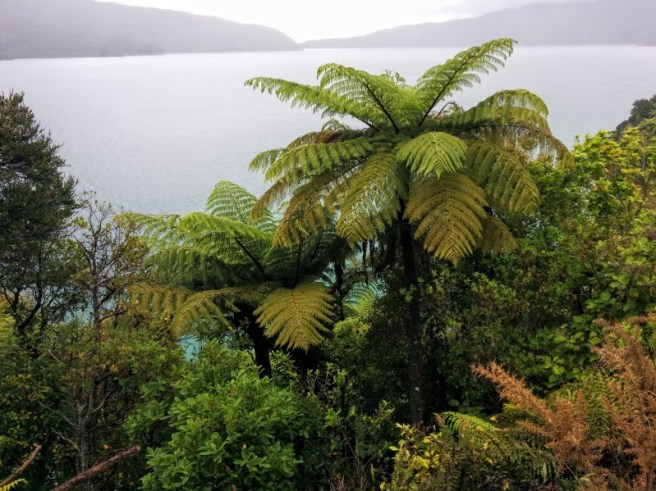
We were now on the southern side of the Inlet and this was the most strenuous part of the Day 2 walk. We seemed to be trudging uphill through forest … a lot. There were tree ferns everywhere sprouting forth.
And little coves with private jetties.
It wasn’t only a sea of green. There were flowering shrubs. One which caught my eye was this one. Have no idea what it was but it had a lovely scent.
Reminds me of an Australian tea tree
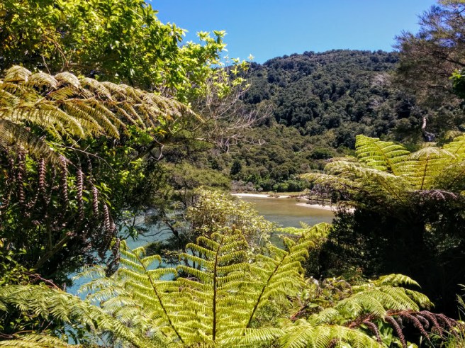
We were rewarded with lovely vistas over secluded coves, perfect for a lunchtime break as we made our way towards Punga Cove and our destination for the night, Mahana Lodge.
Adrift on a sea of aquamarine
It was mid afternoon by the time we reached Punga Cove.We passed the DOC campsite at Camp Bay and then passed the Punga Cove Resort. We were tired and for a moment, I wished I had booked our second night here. But about another kilometer further on, Mahana Lodge awaited us.
Here, hosts John and Ann Martinmade us feel at home. As we were getting acquainted and selecting our dinner menu for the evening, we discovered that John and Ann had lived for a number of years in Kenn’s home town of Condobolin in central NSW. John had worked at the Agricultural Research Station undertaking research into rabbit control in the early 1970s. They remembered the town and its people very fondly. It’s truly a small world.
Our ensuite room in the lodge was spacious and luxurious. After a long, hot shower and wrapped in a super soft complimentary dressing gown, I enjoyed a leisurely afternoon tea. Ann’s wonderful home baking did not last very long I can assure you.
The sitting room in the Lodge. That sofa was very comfortable, a great place for a cuppa and a good book.Storm clouds gather over the homestead, as seen from the sitting room in the Lodge
Dinner in the candlelit conservatory at the homestead was very special and memorable. We enjoyed artisan bread baked by Ann and mussels in white wine as our entree. We chose salmon from the sound, smoked by John to his recipe, over wild rice as our main course which was accompanied by the freshest salad. All ingredients had been picked that day by John from his extensive garden. Food when it’s local and super fresh always tastes amazing. We finished with profiteroles smothered in chocolate and a home made raspberry sauce. Not my usual camping fare I can tell you!
We would have liked to spend longer at Mahana Lodge: explore the cove on the free kayaks, complete some shorter walks around the inlet or watch the glow worms flicker in the creek behind the Lodge.
But the Queen Charlotte beckoned. Day 3, according to Ann, would be challenging yet deeply rewarding!
Sunset over the cove
While many like us were on a mission to walk the whole track, we met others who only had the time to explore one section of the track before resuming their travels. The walk around Endeavour Inletwas definitely the easiest part of the Queen Charlotte. Walkers would definitely have time to explore as well as walk. So if the thought of day hikes of 20 plus kms is a little daunting, you can still immerse yourself in the New Zealand wilderness with this part of the walk.
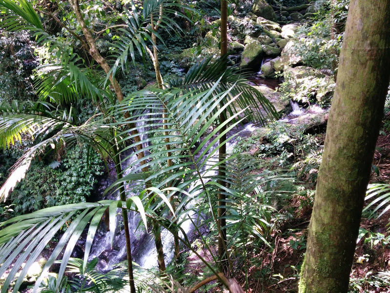
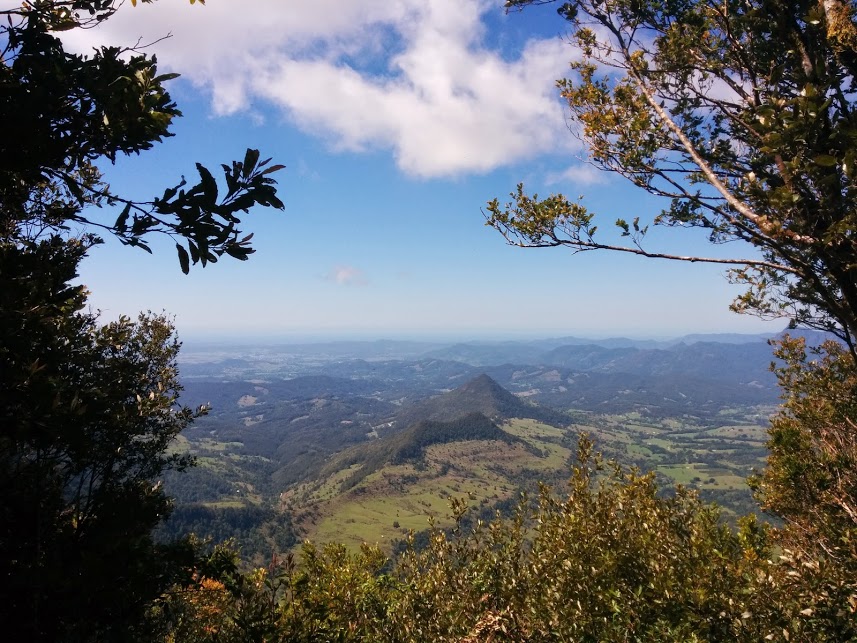
Would you love to walk down a rain forest path shaded by tree ferns and ancient antarctic beech trees? Follow a cascading mountain steam to uncover a myriad of unique waterfalls? Reach a lookout where you can see the forest meet the sea? If so, then the Tooloona Creek Circuit at O’Reilly’s Rainforest Retreat in the Lamington National Park, is the walk for you!
Water cascading over rocks near Elabana Falls
Although our family has visited the Lamington National Parkregularly over the past 20 years, we had never undertaken this particular walk. I had huffed and puffed my way around the 11km Box Tree Circuit, dragged myself achingly, slowly, one step at a time up the mountain from Stairway Falls and nearly had a snake induced heart attack at Python Rock, but I had baulked at the 18 kms Toolona Creek Circuit! It’s not that I’m against exercise per se, but the thought of climbing 1000 metres from Elabana Falls to the ridge line, with a further 9 kms to walk home seemed, well, a trifle excessive.
But Kenn and I are off to the south island of New Zealand in December to walk the Queen Charlotte Track and I knew that some serious training was needed.
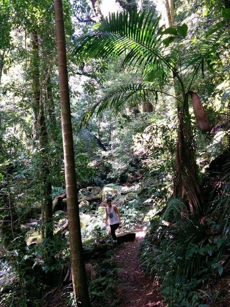
Lyndsay leading the way
So armed with my shiny, new walking boots, I tackled this walk accompanied by Kenn, my daughter, Lyndsay and her fiance Reece. I’m great at walking down hills so the first six kms were easy, We cruised down to Elabana Falls passing beautiful stands of tree ferns and listening to birdsong. We stopped for morning tea at the aptly named Picnic rock and refreshed, were ready to tackle the Toolona Creek section of the walk.
Cascades running over river rocks
Initially, we followed the creek and were delighted by fern encrusted cascades of water rippling over mossy rocks. Then, a couple of creek crossings later, we started to climb. To my surprise, this was much easier than I thought it would be. The track was quite rocky and damp, so we had to be careful and go slow. This suited me perfectly. I certainly haven’t inherited any mountain goat genes!
Around every second bend we encountered a new part of the creek cascading down a unique waterfall. Each one was different, each one was lovely! We counted 17 different waterfalls in total along this section ranging from cascades to the spectacular Toolona Falls.
This is so pretty!Like a veil, covering the rocks.What a drop!Tooloona Falls. photo by me, reworked by google photos! Nice…I think.
Not only were the waterfalls wonderful but the rain forest itself was spectacular. Along this section there were ferny tree gardens growing in the canopy. But all good things come to an end and before we knew it we were on the Border Track.
Near to the intersection of the Tooloona Creek and Border tracks, there is a wonderful lookout with a spectacular view, where we stopped for a well earned lunch.
View from the Border track to Mount Warning and the Pacific Ocean.
Although we still had to walk 9 kms to O’Reilly’s Rainforest Retreat, this was quite easy as it was mainly downhill. About halfway home, we encountered the Antarctic Beeches. These are amazing trees, remnants of when Australia was part of Gondwana! This is a wonderful part of the rain forest, so dark and so deep. All too soon, we were back. Ready to enjoy Happy Hour and watch the sun set over the ranges.
Sunset over the ranges
The Toolona Creek circuit is located in the Lamington National Park in the Gold Coast Hinterland, about two and a half hours drive from Byron Bay. We stayed at O’Reilly’s Guest Housein a Rainforest Villa which was a wonderful experience in itself. We didn’t have time luxuriate in the Lost World Spa, one of the many amenities at the resort, but next time it’s definitely on our list of things to do. Maybe you would like to join us some time?
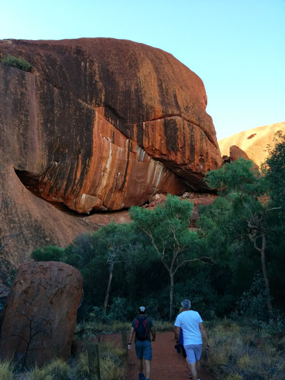
Nature’s big things are truly impressive. For instance, when my sister Jenny and I flew over the Grand Canyon in a helicopter, we were struck by its enormous scale: Deep, long and rugged, it was surrounded by beige desert so different from the colours in Australia. It was awe inspiring but somehow remote. We were only able to get up close and personal with the canyon when we landed halfway down on a rocky outcrop. We admired the view, stretched our legs and scoffed a champagne lunch. It was an unforgettable, exciting experience, after all you don’t get to ride in a helicopter or a limousine every day. But, there wasn’t time to immerse ourselves in the colours, textures, scents and spiritual history of the the canyon itself. This is not the case when you visit Uluru, Kata Tjuta and King’s Canyon in the Red Centre. There your senses are saturated as you trek, stroll or saunter along paths that have that have been part of Aboriginal Dreaming for thousands of years.
All of the walks are around 10 kms in length, vary in difficulty and take a few hours to complete. I undertook these walks with my husband, Kenn and friends, Helen and Phil. Although capable of setting new land speed records and clambering up cliffs like mountain goats, these three intrepid trekkers slowed their pace to accommodate my more slothful saunter. I suspect the thought of having to carry me back to base, a victim of exhaustion or a premature heart attack might have been part of their motivation.
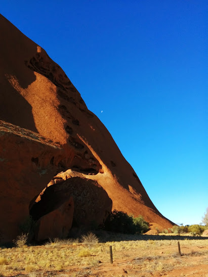
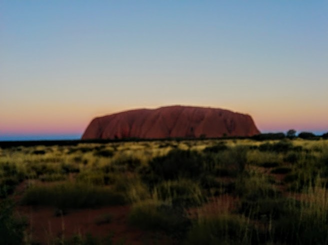
Our first walkwas around the base of Uluru, the biggest monolith on Earth. It dominates the flat expanse of the desert for as far as the eye can see.
Setting a cracking pace. Sunset is not far off.
The path is well marked and the rock is there beside you, revealing different faces as the light moves.
I was surprised by the amount of vegetation and the sense of mystery you feel in the shadows.
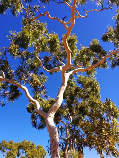
Desert Oaks
We completed this relatively easy walk with enough time to get to the sunset viewing area. Nature puts on the most amazing light show as the rock lights up and the sky is smudged with many of the colours of the rainbow.
Smudgy colours soften the rock
Our second walk was far more challenging. We hired a 4WD and drove 300 kms to King’s Canyon. What I didn’t realise, until I reached the starting point of the walk, was that you have to climb 500 steps up a cliff face to begin!
I think I can, I think I can!
Kenn appointed himself as my personal water boy and with his help I made it. This was definitely the hardest part of the walk. The views from the canyon’s rim were amazing and almost made the memory of the 500 steps melt away. Almost ..
I think I can, I think I can!
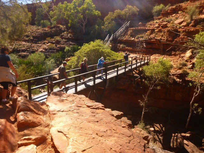
We clambered over rock platforms and negotiated bridges onto sandstone spurs.
And … hidden away deep within the canyon was ‘The Garden of Eden’.
What a gem!
This place is significant for the Aboriginal people and it was easy to see why. In the midst of so much dryness, hidden from the unrelenting sun, the water is cool, sheltered by ferns and palms. It is very quiet there. Like all who went before us, we were refreshed and restored and finished this walk on a high.
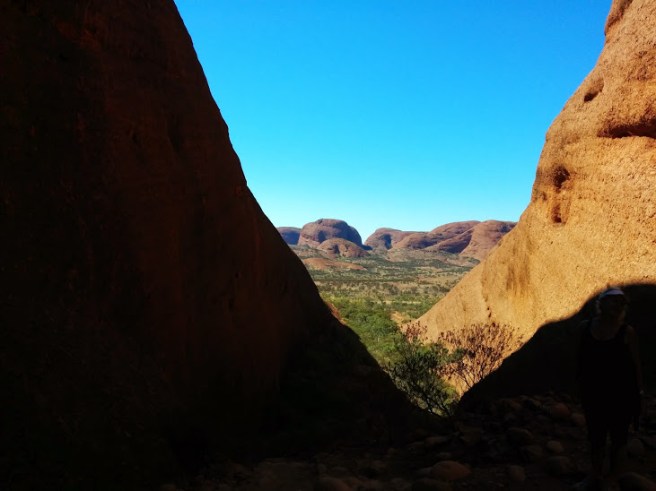
Our third walkwas also challenging and in my opinion, the most rewarding of all. This was the ‘Valley of the Winds’ at Kata Tjuta or the Olgas. We decided to do the whole walk, which is a loop, but you can do shorter sections if you wish. It’s only about 50 kms from Yulara, the Uluru township. The first part of the walk from the car park to the base of the Olgas is quite long and for a time, you could easily imagine that you were walking on the moon.
Path to the OlgasKenn striding out in the moonscape
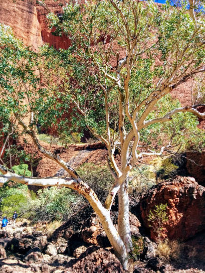
But then you turn a corner and find yourself walking in between the beehive domes of sandstone that are the Olgas. The wind whistles around you, an unusual experience as usually it is really quiet out here. In places there is enough water to support vegetation; we walked through a lovely avenue of ghost gums.
Part of the ghost gum avenue
Winding in and out of the domes, down and up rock faces, we reached the lookout. Again, like everywhere around Uluru, there was an amazing vista.
Lookout view
We scrambled down a steep incline. It was at this point that I started having a few worries. It was so steep that I negotiated most of it on my bottom. As I was sliding from rock to rock, getting rid of my cellulite, I started thinking about how I was going to climb back up! It would be a tough ask at the end of a long walk. I felt totally knackered just thinking about it. But we had come so far! At the bottom we found ourselves inhaling the scents of the savanna surrounding the Olgas, that unforgettable, eucalyptus smell of the Australian bush. Tramping through mulga, spinifex and assorted grasslands we had wonderful views both of the desert stretching away in one direction and the Olgas standing guard in another.
View from the Savanna of the Olgas.
We didn’t have to retrace our steps. I was saved from the slippery cliff of hell. A relatively gentle climb found us back among the Olgas via a different route and eventually we made our way to the car park.
All the walks were special and were, for me, the most memorable part of my visit to Uluru. It is a very personal way to connect with this ancient landscape and its dreaming.
If you haven’t visited Uluru yet, I hope you are able to soon. It really is a very, very special part of the world.